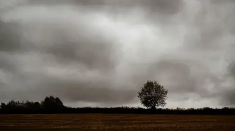
South West had unusually warm weather in 2025
 Debbie W/BBC Weather Watchers
The south-west of England experienced an unusually warm year of weather in 2025, with notably dry and sunny conditions in the spring.
The Met Office said it was the sunniest year on record in the UK, and has the potential to be the warmest - the existing record being 2023.
In the region, March was the sunniest ever recorded, while May only saw 70% of the normal rainfall.
The year ended in memorable style too, with December being one of the wettest on record with 525mm (20.67in) of rain falling in the month on Dartmoor alone.
Mild temperatures
January saw cold conditions at first and then became wet and windy with two storms.
On 24 January, the fifth named storm of the 2024/2025 winter season, Eowyn, brought strong winds to parts of the Cornwall and Devon with gusts of up to 66mph (106.2km/h).
This was followed by Storm Herminia on 26 and 27 of January, which led to heavy rain and gusts of wind over 80mph (128.75km/h) in south Devon.
February was mostly dry with a short period of unsettled weather on 23 and 24 of the month.
It also saw below average rainfall for the South West - 73% of the long-term monthly average.
March saw persistent high pressure bring settled conditions for most of the month.
It began with high pressure over southern England, resulting in bright but cooler than average temperatures in the South West, with mild temperatures by the end of the month.
It was the sixth driest March on record and the sunniest ever recorded.

April was another unusually dry month, with high pressure most of the time, and just over half (51%) of the normal amount of rainfall for the month.
It was the third warmest April on record.
May was the second warmest on record in terms of mean temperature for England and only saw 70% of normal rainfall.
The warm weather continued and June was the warmest on record for the South West and UK's second warmest on record.
After the very dry spring, a sequence of Atlantic weather systems in the early part of the month, combined with occasional thundery breakdowns thereafter, resulted in near or above average rainfall.
On 12 June, heavy downpours and flooding led to disruption across Devon and Cornwall.
July saw a hot spell between 9-14 of the month, with yellow and amber heat-health warnings issued by the UK Health Security Agency.
Apart from a few heat generated thunderstorms, rainfall amounts in places were less than 50% of the long term average.
August saw showers, thunderstorms and a heatwave.
It also brought the sixth named storm of the year, Storm Floris, which arrived on 4 August with strong winds and heavy rain.
Additionally on 25 and 26 of the month, the South West saw increased rainfall due to the remnants of Hurricane Erin.
South-west England saw just 43% of the long term rainfall average, much of this from the final week of August.
September was wetter than average, with between 150% and 170% of the normal rain having fallen by the end of the month.
 Krazy Keith/BBC Weather Watchers
October saw settled and unsettled weather with a fortnight of quiet, anticyclonic weather between 5-18 of the month.
This was bookended by a very unsettled start which included the first named storm of the 2025/2026 season, Storm Amy.
It was the dullest October in record for 60 years.
The night of the 22-23 October saw Storm Benjamin bring strong winds and heavy rain.
November saw a more traditional season weather for autumn.
It was unusually mild at first, with the daily minimum falling to only 14.8C (58.64F) at Chivenor, Devon, on 5 November.
The period from the 9-14 November saw a complex low pressure centre moving slowly west of Biscay.
This was named Storm Claudia by the Spanish Met Service and was responsible for some very wet weather.

Storm Bram affected the South West in the beginning of December, bringing wind of 70 mph (112.65km/h) and distinctly heavy rain.
It was one of the wettest Decembers on record, with Dartmoor receiving 525mm (20.67in) of rain in the month, Plymouth 276mm (10.87in) and Bodmin 296mm (11.65in).
The average rain total for December would normally be 150mm (5.9in).
As of 14 December, the reservoir levels in the South West were at 75%, compared to the 90% full in December 2024.
Follow BBC Cornwall on X, Facebook and Instagram. Follow BBC Devon on X, Facebook and Instagram. Send your story ideas to [email protected].
