
Yes, summer is here and it arrived with a bang! We had the hottest day for June in a decade on Tuesday when the mercury hit a sizzling 29°C in Hawarden. Then on Wednesday came the hottest July day on record for the UK as Heathrow reached a sweltering 36.7°C. Here in Wales though we had a lot more cloud so no records were broken. But it’s still early days - plenty of time to break records here too!
I must admit it has been a bit uncomfortable for some but it’ll feel a bit fresher on Thursday. Make the most of it as we'll see the return of the hot and humid conditions on Friday. The pressure chart is showing high pressure controlling our weather from the east, and low pressure to the west. With that set-up we'll see more warm air being dragged up from the south.
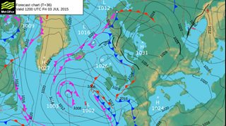
Met Office Pressure Chart for Friday 3 July
So we end the week on a hot and sunny note. By Friday night though you’ll need to head back indoors as we do have stormy weather heading our way triggered by the heat. It’ll be a very lively Friday night becoming drier by the early hours of Saturday morning.

Lightening over the Great Orme. Picture taken by Derren Jones
The weekend is not looking too bad. Saturday will be breezy with a mixture of sunshine and the odd isolated shower making it feel fresher. There will be lighter winds on Sunday with sunshine and showers and a risk of rain by the time we get to Monday.
I'll leave you with this beautiful sunset in Tenby sent in by Mandy Llewellyn.

Tenby sunset by Mandy Llewellyn